Woodland Caribou
Provincial Park 2001


|
We
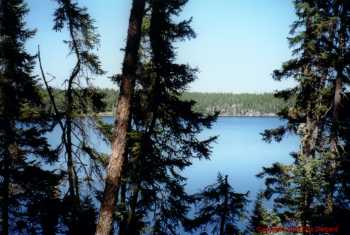
traveled from August 20 through September 3, 2001 in the southeast
quadrant of the park, and had a very peaceful and enjoyable trip.
This was our first trip into the park.
Initially, we were concerned
that we might get lost or not be able to find help if we needed it.
Once we were there, we found the 1:50,000 scale topographic maps
were somewhat difficult to use and sometimes inaccurate (South Agean
islands near Agean Lake comes to mind). Maps with more detail
would've been nice, but I don't believe any exist. The blazed/marked
portages were almost always easy to find, and while we were often
unsure until we found the portage, we never actually got
lost.
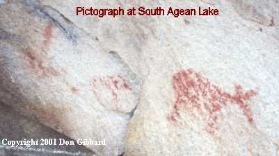
For our canoe rental and shuttle service to Leano Lake, we used Eric Mosley's Woodland Caribou Outfitters in Red Lake (WoodlandOutfitters.com). On the evening before going in to the park, Eric took a lot of time to go over our trip route with us. He made notes on our maps to show us some good campsites along our route and also detailed pictograph locations. He provided us with prompt, timely round trip shuttle service between Red Lake and the Leano Lake access point. It should be noted that there are very few signs on the road to Woodland Caribou's Leano Lake access point making it difficult to locate it or any other access spots. (Since our trip in 2001, Woodland Caribou Outfitters has been sold to Tamara and Jim Copeman.)
Driving from Red Lake to the Leano Lake access point on the sporadically maintained dirt road takes at least 90 minutes and possibly longer - depending on the current road condition and on how concerned you are about the condition of your vehicle's running gear. Using Eric's shuttle saved us wear and tear on our car and we got a lot of interesting information about the area's natural features - especially the area's geology since Eric used to work an exploration geologist.
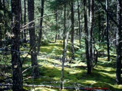
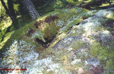
With regards to our canoe trip, we had a safe trip with no significant accidents. We seemed to get a bit more scratched up than on our prior trips, but we arrived back in good health. I feel that is the first standard to evaluate when determining if we had a good trip. The closest we came to a significant accident was when I was wandering through the forest and I fell into a "moss hole." Much of the virgin jack pine forest floor is covered with a beautiful, deep-green moss. In an area I was walking in, the moss somehow managed to span across about a 3' divide between two large rocks. I was walking along on the rock and moss and suddenly fell up to my hip on one side and right up against one of the rocks. Ouch!!! Fortunately, no real damage was done except to my fragile ego. |
|
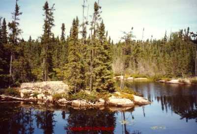
Just minutes before I fell into the moss hole, I had cautioned Peg about watching for moss holes (even though I had never seen or heard of such a thing). I'd somehow reasoned that there was so much thick, green moss covering the forest floor that it might just cover holes in the ground. Even now, it is a bit unnerving to think that you can just be walking along out there and step into a hole without any visible signs that it even exists. To me, it seems difficult to really assure one's safe footing when walking on the moss carpet. And I'm not convinced that the moss only covers gaps between large rocks... I guess that's the downside of the moss. On the bright side - I really liked seeing all the deep, green moss. Throughout much of our trip (except in recent burn areas), the moss carpeted much of the forest floor. For whatever reason, I found that amazingly beautiful! For me, this moss, more than anything else, really seemed to distinguish this park from Quetico Provincial Park.
Throughout our canoe
trip, there was a fair amount of air traffic overhead during the
day. There is significantly more than Quetico. While we
didn't really like the air traffic, it did give us the sense that if
we needed help we could summon it. Later, we found out that some of
the air traffic was due to a search for a lost canoe party.
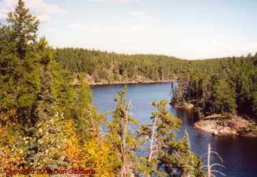
This park did give us the solitude we were looking for. During the first two days, we only saw 2 different canoe parties for a total of three people - one canoe "party" was just one person in a solo canoe. For the next 7 days, we traveled 40-50 miles on major routes and never saw another person. To us, the most incredible aspect of that was that we weren't hiding out off the beaten paths. (We've used the strategy of taking little used routes before in Quetico and it has worked quite well for us.) Instead, for this trip, we were on major routes and we were camping at some of the most beautiful, established campsites we've ever been in. We kept expecting someone to come along thinking that they too wanted to stay at the best campsite on the lake. To our knowledge, we never had anyone canoe up to our campsite expecting to use it. There were many times that we felt we "owned" a very large lake since, as far as we could tell, no one else was there. The park appeared deserted to us for much of the time and that was just fine with us. The portages were in excellent condition. We were very impressed! (We extend our compliments to the portage crews.) Claire Quewezence, the assistant park superintendent, was an exceptionally good resource for us. Prior to our trip, we emailed our itinerary to her. She made extensive, invaluable, detailed comments and sent them back to us. (Thank you Claire!) |
|
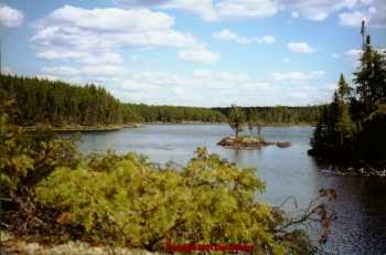
There was a difficult passage on Nutria
Lake/Creek going to Mexican Hat Lake. It required lots of tugging,
pushing, and lining the canoe, but it was passable. It appeared that most
of the low-water problem was due to the fact that the final beaver dam at
Mexican Hat Lake had been broken down. Hopefully, the beavers will stay
busy and rebuild the beaver dam before next season!
Fortunately for us, Claire had warned us about the low
water. Knowing we should expect tough conditions ahead of time
really made that travel day easier to deal with. (We have
since learned the beavers repaired their dam, but its status could change
at any time...)
|
Without a doubt, the best web site we've found for Woodland Caribou park canoe trip travel logs is at CanoeStories.Com. Jim Hegyi is one of several authors presenting their canoeing stories at the web site. Peg and I are indebted to Jim for his generous contributions to wilderness canoeing in general and canoeing in the Woodland Caribou Provincial Park in particular! His site's canoe stories/travel logs covering trips into Woodland Caribou and other areas are a great resource for general reading enjoyment and also for specific trip information. We were able to glean some good information to help us prepare for our trip by reading these stories/trip logs. I particularly enjoy Jim's writing style. His stories have a nice reflective quality to them which reminds me of Robert Pirsig's style in his book "Zen & The Art of Motorcycle Maintenance."
|
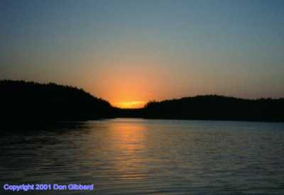
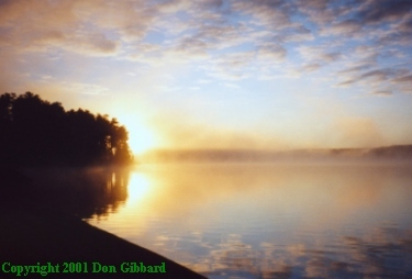 Mexican Hat Lake Sunrise
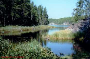
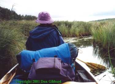 Low-water slog thru Nutria to Mexican Hat Lake